Monte Baldo mountain bike itineraries
Due to the ground conditions caused by the snow, the service is currently suspended
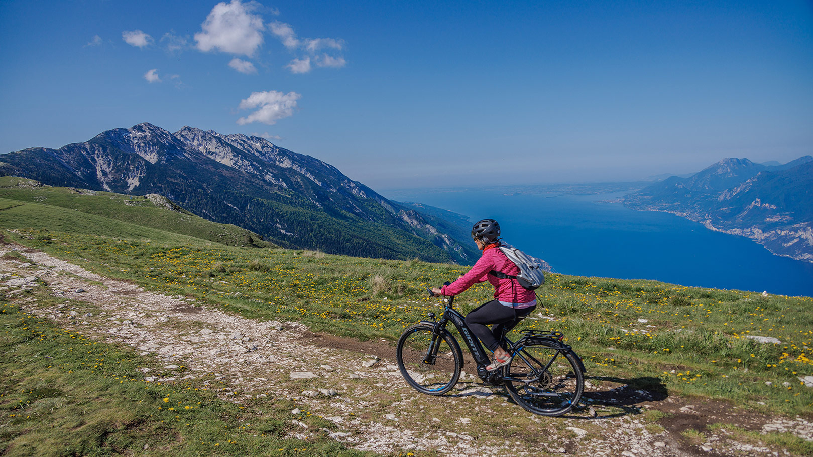
When warm weather arrives, nature lovers should not pass up the chance to ride one of Monte Baldo's many mountain bike routes.
From May to the end of the season, the Funivia di Malcesine / Malcesine cable car provides special rides at 8:25, 8:55, 14:15, 15:15, 16:15 and 17:15, one-way trip, for the transport of bicycles, with 24 cabin seats available per hour. This makes it easy for biking enthusiasts to reach the uphill station, load their bicycles into the cabin, and then descend to the valley along beautiful and panoramic nature trails of varying levels of difficulty.
Please remember that you may not ride freely through the meadows. Instead, you must stay on the marked routes and respect nature, the grazing livestock, and hikers.
We would also like to remind you that you should choose the Monte Baldo mtb path to follow according to your own abilities, level of training, and technical knowledge. All routes are maintained by third parties and are only mentioned here.
Excursions and itineraries are carried out entirely at the risk of each individual user.
As a result, we are not responsible for events resulting from the use of the information contained in this sheet.
Below, we recommend 3 routes of medium and great difficulty.
The 3 itineraries
Departure from Tratto Spino, continuing to: Bocca di Navene - Bocca del Creer - Malga Bes - S. Valentino - S. Giacomo - Festa -Brentonico - Castione - Loppio - Nago - Torbole - Malcesine
The itinerary, which parts from the uphill cable car station and descends the eastern slope, is 35 km long (50 km if returning to Malcesine by bike from Torbole) and takes 4 hours. It ascends for 375 metres and descends 1958. The itinerary includes different types of terrain, asphalt and concrete, dirt roads and paths.
The environment is varied, starting in the mountains and arriving on the shores of Lake Garda through characteristic mountain areas and pastures.
4 hours
Time
375 metres in ascent and 1958 in descent
Height difference
35 km; 50 km for those returning to Malcesine
Length
medium
Level
Departure from Tratto Spino and continuing along the Signor - Faigo - Malcesine forest trail.
A freeride route from Monte Baldo to Malcesine down the western slope. You will leave from the cable car station, descend along trail 11, then along the forest path and on Via dei Prai to San Michele. From San Michele, head to Malcesine via Faigo and trail number 4.
The itinerary is 11 km long with a 1700-metre change in height downhill.
Caution: some sections of trail 11 and trail 4 are very technical and messy, with loose rocks, and are recommended for experienced bikers.
1 hour and 30 minutes
Time
1700 metres in descent
Height difference
11 km
Length
difficult
Level
This itinerary begins at the uphill cable car station and reaches Malcesine, ascending Monte Altissimo di Nago and descending to Navene along trails 601 and 6.
This is a difficult enduro itinerary recommended for experienced and trained bikers.
It is about 30 kilometres long (for those returning to Malcesine), with a height difference of 700 metres in ascent and over 2000 in descent. The terrain is all gravel and highly varied, from loose and very technical rock to flowing single trails.
5 hours
Time
700 metri in salita e 2000 in discesa
Height difference
30 km
Length
difficult
Level